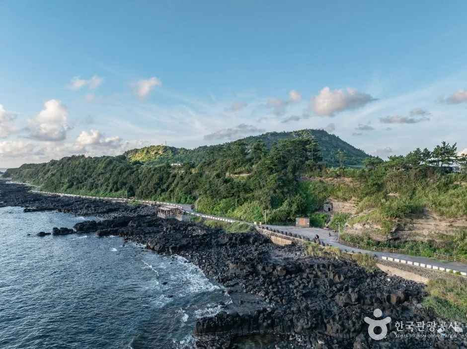
A volcanic tuff-cliff viewpoint and exposed west-coast walk overlooking Chagwido; strong wind, rain and rough seas can make paths unsafe, so check conditions and sunset return transport. This catalogue page connects the stop to traveller ratings, current field reports, nearby regional anchors and sourced community corrections.
Help the next traveller understand Suwolbong and Chagwi Coast.
Visitor insight appears after a real contribution, so empty counters never stand in for activity.
Ask a question or share a current update
Recent traveler reports
Answered by travellers, not checked by us. The verified facts above carry the date we confirmed them.
Loading traveller reports…
Questions about this place
Drafts can be restored in this tab and sign-in session for 24 hours. Saving does not post them; expired copies are not automatically deleted.
Question request recovery is not ready. Recheck your account and saved draft before posting.
TODAY AT THIS PLACE
Ask people visiting Suwolbong and Chagwi Coast today.
Each room follows the Seoul calendar day, then becomes a read-only visit record. Share current waits and practical tips without publishing your precise location. Group push notifications stay off during beta.
PLAN THE VISIT
Good to know before you visit
Operator facts are labeled separately from Korea Era estimates and guidance.
A reviewed foundation built from official sources. Traveler edits are checked before publication.
RegionJeju-si · JejuKorean map search제주 수월봉과 차귀해안Published accessAlways open · year-round ↗Geosite boundaryObserve only · no rock, fossil or plant collectionCliff boundaryBarriers and erosion setbacks override a photograph or map traceTide boundaryShore access, spray and escape margin change with tide and swellRoute boundaryConfirm the signed Geo Trail segment, distance and returnWeather boundaryWind, rain, heat, fog and lightning can make the exposed coast unsafeParking boundaryParking is listed; legal capacity and road access remain livePhoto scopeCurrent hero shows the real layered Suwolbong sea cliffs and Chagwi coast
It does not prove trail opening, low tide, calm wind, sunset visibility, safe cliff access or parking.
Does always open mean the full coastal trail is always safe?
No. Erosion, wind, waves, tide and maintenance can restrict individual segments at any time.
Can I collect a small volcanic rock?
No. Treat the geosite as observe-only and leave geological and biological material in place.
Are the operating details for Suwolbong and Chagwi Coast live?
The displayed guidance was checked August 29, 2026, but it is not a live operator feed. Open the linked official guide and a Korean map again on the day because hours, closures, tickets and transport can change.
Can a traveller correct this page?
Yes. Submit a sourced community wiki correction or a current field report; proposed facts are reviewed before becoming canonical information.
KOREA ERA SHARE
Send this without forcing a sign-up
Public link · Anyone can view
Save this for your Korea tripNo account required during beta.
TRAVELLER CHANNELS
See Suwolbong and Chagwi Coast through a traveler's own post.
Direct links only. Korea Era does not copy the post, imply endorsement or verify live conditions from it.
A volcanic tuff-cliff viewpoint and exposed west-coast walk overlooking Chagwido; strong wind, rain and rough seas can make paths unsafe, so check conditions and sunset return transport. This catalogue page connects the stop to traveller ratings, current field reports, nearby regional anchors and sourced community corrections.Recheck the official source before visiting.
Read the full Wiki articleDetailed facts, sources and revision history
KOREA ERA WIKI
TRAVEL KNOWLEDGE DOCUMENT
Suwolbong and Chagwi Coast
수월봉과 차귀해안A reviewed foundation built from official sources. Traveler edits are checked before publication.
Document statusReviewed foundation5 current facts0 recent approved edits
Global is the shared verified foundation. Country editions add approved local guidance; ratings, discussions and edit histories stay separate.
Showing the shared Global facts and Global edit history.
A volcanic tuff-cliff viewpoint and exposed west-coast walk overlooking Chagwido; strong wind, rain and rough seas can make paths unsafe, so check conditions and sunset return transport. This catalogue page connects the stop to traveller ratings, current field reports, nearby regional anchors and sourced community corrections.
Observe only · no rock, fossil or plant collection
Cliff boundary
Barriers and erosion setbacks override a photograph or map trace
Tide boundary
Shore access, spray and escape margin change with tide and swell
Route boundary
Confirm the signed Geo Trail segment, distance and return
Weather boundary
Wind, rain, heat, fog and lightning can make the exposed coast unsafe
Parking boundary
Parking is listed; legal capacity and road access remain live
Photo scope
Current hero shows the real layered Suwolbong sea cliffs and Chagwi coastIt does not prove trail opening, low tide, calm wind, sunset visibility, safe cliff access or parking.
Does always open mean the full coastal trail is always safe?
No. Erosion, wind, waves, tide and maintenance can restrict individual segments at any time.
Can I collect a small volcanic rock?
No. Treat the geosite as observe-only and leave geological and biological material in place.
Are the operating details for Suwolbong and Chagwi Coast live?
The displayed guidance was checked August 29, 2026, but it is not a live operator feed. Open the linked official guide and a Korean map again on the day because hours, closures, tickets and transport can change.
Can a traveller correct this page?
Yes. Submit a sourced community wiki correction or a current field report; proposed facts are reviewed before becoming canonical information.