KOREA ERA · LIVE TRAVEL BOARDSeoul detail · events across Korea · Busan and Jeju city hubs
Korea Era

City day · TOPIC 26 / 200 · CHECKED 2026-08-22

West Jeju in one day — check the tide first

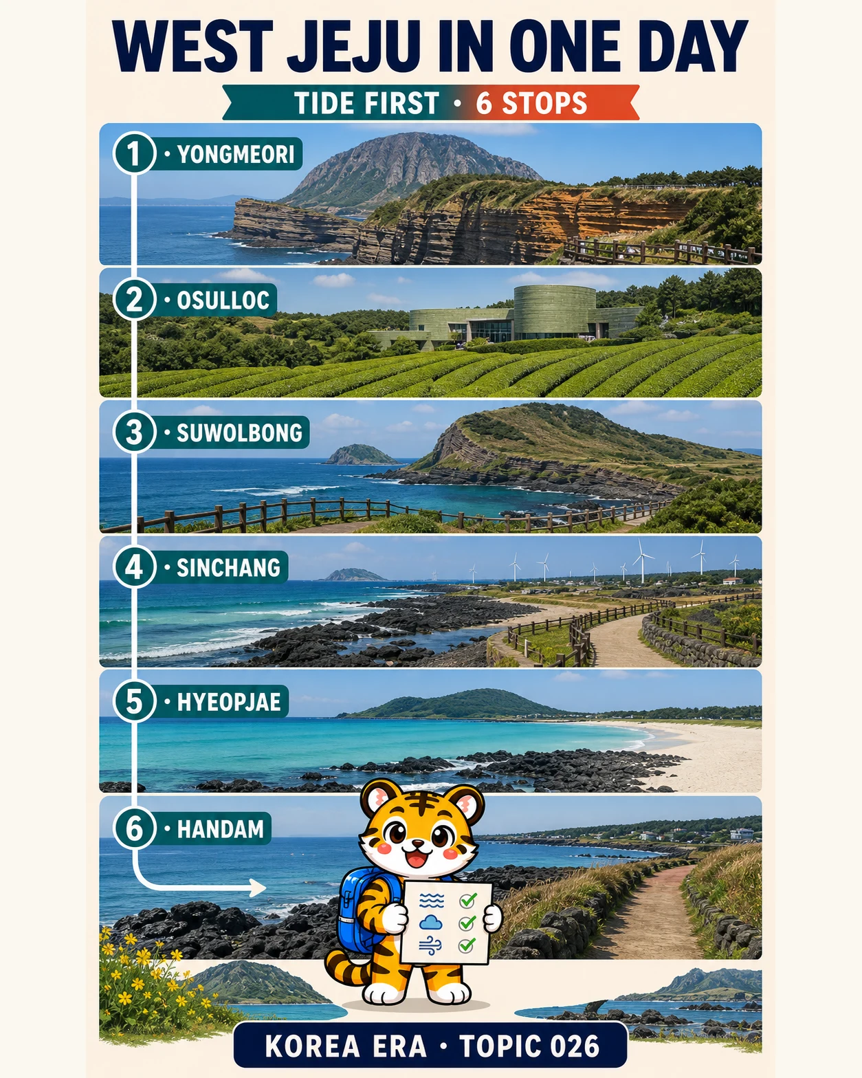
제주 서쪽 하루 여행 코스Test the tide-sensitive southwest coast first, pause at the tea museum, then follow volcanic strata, windmills and pale beaches north toward Aewol.
Six west-Jeju stops ordered around the day's hardest access decision.
Korea Era tiger mascot holding a tide and weather checklist beside six west-Jeju route panels from Yongmeori to Handam
Illustrated overview · live details and sources are listed below.
TIME
1 day · 6 stops
BUDGET
Admission + food + rental car costs
BEST FOR
First west-Jeju day · coast and geology
MOVE
Rental car preferred · bus users reduce the route

THE EDITED ROUTE

6 stops, each with a reason.

Times create a useful rhythm. They are not promises about opening hours or travel time.
01

TIDE FIRST · SOUTHWEST TO NORTHWEST

Put the fragile coast first, then protect the northbound finish

The clock times are pacing suggestions, not opening hours. Check Yongmeori's same-day tidal access before leaving; when it is closed, use the Sanbangsan–Sagye public viewpoint and continue without waiting for a reopening.
  1. 01

    Yongmeori Coast or Sanbangsan fallback

    용머리해안 · 산방산 대체

    Make the tide- and weather-controlled coast the first decision. If entry is restricted, view the geology from the permitted Sanbangsan or Sagye area and keep the day moving.

    Confirm same-day admission and permitted visiting windowThe coastal route is wet, narrow and uneven; pets are not permitted and barriers override every saved plan
  2. 02

    OSULLOC Tea Museum

    오설록티뮤지엄

    Move inland once for Korean tea context, a weather-resistant pause and an early lunch before returning to the exposed west coast.

    Museum access, products and booked programs differA commercial venue is not permission to enter private tea rows; confirm sold-out programs, ingredients and last orders
  3. 03

    Suwolbong Peak and geotrail

    수월봉 · 지질트레일

    Read Jeju's volcanic ash layers and Chagwido view before the route turns north along Hangyeong's coast.

    Public viewpoint; interpretation programs require a current checkChoose the short viewpoint when wind, heat, mobility or time makes the lower geotrail unsuitable
  4. 04

    Sinchang Windmill Coastal Road

    신창풍차해안도로

    Continue north to the ecological walkway and offshore turbines instead of crossing the island for another attraction.

    Confirm legal parking before walkingHigh tide can push water onto the path; never enter a flooded section or stop a vehicle in the road for a photo
  5. 05

    Hyeopjae Beach

    협재해수욕장

    Use the connected pale-sand coast and Biyangdo view as a beach stop, not a promise that swimming is supervised today.

    Parking, rentals and seasonal services varyEnter the water only in a currently designated zone during supervised hours and follow live wind, wave and pet rules
  6. 06

    Aewol Handam Coastal Trail

    애월 한담해안산책로

    Finish on the northwest basalt trail so the final drive points toward Jeju City rather than back to the southwest.

    Parking and cafés vary independentlyThe trail is the destination; sunset, café seats and a fast airport transfer are never guaranteed

ROUTE MAP

West Jeju in one day — check the tide first

6 saved stops
Route map · ordered stops and live map links are ready below.
TIDE FIRST · SOUTHWEST TO NORTHWEST
The line shows editorial order, not turn-by-turn navigation. Check live routing before leaving.

YOUR DAY, IN PROGRESS

Carry this edit through the day.

Mark each stop as you go. Your progress stays on this device.
Korea Era tiger mascot celebrating a completed route
0of 6 stops
0%

TIDE FIRST · SOUTHWEST TO NORTHWEST

No account needed. This checklist is saved only in this browser.

MAKE IT YOUR TRIP

Add the full route to your trip.

Korea Era adds all 6 ordered stops to one editable trip. Choose the day you plan to go.

EDITOR’S NOTES

The choices that make this edit work.

FIRST DECISION

Open Yongmeori's live notice before driving

Tide, waves and weather set a daily access window. Closed means Sanbangsan or Sagye viewpoint, not waiting at the gate or crossing a barrier.

The fallback is part of the route
CUT RULE

Late day? Remove one long walk

Use the short Suwolbong viewpoint, or remove Handam when queues and daylight disappear. Six pins are not a reason to hurry a tidal or cliff path.

Protect daylight and the final drive
AIRPORT

Aewol is a direction, not a buffer

Northwest traffic, dinner, fuel or charging, rental inspection, shuttle and security all need separate time. Remove the finish when flying the same day.

Build the buffer before the café

BEFORE YOU GO

What can still change

  • This is one calendar day with six ordered stops: Yongmeori/Sanbangsan fallback → OSULLOC → Suwolbong → Sinchang → Hyeopjae → Handam. The first inland bend protects the fragile coast; the rest of the day works north along western Jeju.
  • Yongmeori access is decided by tide and weather. Visit Jeju directs visitors to the official Seogwipo public-attraction channel for that day's available visiting window; a static article time, old review or campaign image cannot prove entry.
  • When Yongmeori is closed, do not wait for an assumed reopening and never cross a barrier. Use a permitted Sanbangsan, Sagye or Hamel-area viewpoint, then continue to OSULLOC on schedule.
  • OSULLOC Tea Museum is a commercial cultural venue. Recheck its official site for hours, reservations, severe-weather program substitutions, sold-out products and accessibility; do not enter private or restricted tea fields.
  • Suwolbong's upper viewpoint and the lower coastal geotrail require different time and footing. Strong wind, heat, rain, cliff exposure or mobility needs are reasons to keep only the viewpoint.
  • Sinchang's official page warns that high tide can push water onto the walkway. Do not enter flooded sections, climb structures, trespass near turbines or stop in the traffic lane for a photograph.
  • Visit Jeju lists Hyeopjae's 2026 supervised beach period as June 24–September 6, with seasonal operating hours. Outside a currently designated, staffed zone, treat it as a shore visit rather than permission to swim.
  • Handam is a coastal walk toward Aewol, not a guaranteed sunset, café seat or airport shortcut. Remove it when darkness, weather, crowding or a same-day flight makes the finish fragile.
  • The listed clock times are pacing suggestions, not official opening hours or guaranteed arrivals. Navigation, parking, queues, tidal notices, daylight and closures must be rebuilt on the travel date.
  • Public-transport travelers should use the separate car-free Jeju guide and live Jeju Bus Information System. Keep three or four compatible stops rather than copying this six-stop driving schedule onto rural transfers.
  • Do not drive after alcohol, when exhausted or in severe wind, rain or snow. Keep a charged phone; call 112 for police, 119 for fire or medical emergency and 1330 for multilingual travel help.

USEFUL KOREAN

4 phrases for this edit

오늘 용머리해안에 들어갈 수 있어요?
Can I enter Yongmeori Coast today?
용머리해안이 닫히면 어디에서 볼 수 있어요?
Where can I view the area if Yongmeori is closed?
이 길은 만조 때도 안전해요?
Is this path safe at high tide?
공항까지 얼마나 걸려요?
How long does it take to the airport?

CHECKED SOURCES

The illustration is not the source.

Changing facts are linked to the public body or tourism operator responsible for them.
  1. Official Jeju Tourism GuidebookCurrent official west-Jeju map, route and same-day-check context.Open official source ↗
  2. Visit Jeju · Yongmeori CoastOfficial geology, pet restriction and direction to check the day's tidal visiting window.Open official source ↗
  3. Visit Jeju · Sanbangsan–Yongmeori geotrailOfficial fallback walking and geological context around the same southwest cluster.Open official source ↗
  4. Visit Jeju · Sagye BeachOfficial public-view context for Sanbangsan, Yongmeori and Hyeongje Islets when coastal entry is unavailable.Open official source ↗
  5. Visit Jeju · OSULLOC Tea MuseumOfficial tea-cultural venue, program and operator information; current operator notices still control.Open official source ↗
  6. OSULLOC · official museum sitePrimary commercial source for current visitor hours, programs, bookings and product availability.Open official source ↗
  7. Visit Jeju · Suwolbong PeakOfficial viewpoint, volcanic strata, Chagwido and geotrail information.Open official source ↗
  8. Visit Jeju · Suwolbong Geo TrailOfficial lower-trail and landscape context; route conditions require a live check.Open official source ↗
  9. Visit Jeju · Sinchang Windmill Coastal RoadOfficial walkway, turbine and high-tide overflow caution.Open official source ↗
  10. Visit Jeju · Hyeopjae BeachOfficial Biyangdo view and 2026 designated swimming-period information.Open official source ↗
  11. Visit Jeju · 2026 beach guideCurrent official beach-season dates, staffed hours and visitor-safety context.Open official source ↗
  12. Visit Jeju · Aewol Handam Coastal TrailOfficial northwest coastal-walk direction and connection toward Gwakji.Open official source ↗
  13. Jeju Bus Information SystemOfficial live route, stop, arrival and service-notice source for a reduced transit version.Open official source ↗
  14. Korea Tourism Organization · 1330Official multilingual travel helpline and emergency-support context.Open official source ↗

NEXT EDIT

Choose another kind of day.

3 nights · 4 daysSeoul in 3 nights and 4 real days3 nights · 4 calendar daysCity dayOne first day in Seoul without crossing the city twice1 day · suggested 09:00–20:00Budget dayA full Seoul day for ₩50,0001 day · 08:30–20:30