KOREA ERA · LIVE TRAVEL BOARDSeoul detail · events across Korea · Busan and Jeju city hubs
Korea Era

Nature reset · TOPIC 27 / 200 · CHECKED 2026-08-22

South Jeju’s quiet six — pick two, not one route

제주 남쪽 숨은 명소 여행Six slower landscapes across southwest Andeok, the Seogwipo edge and southeast Namwon — grouped so you choose two nearby places instead of racing across the whole south coast.
A quieter south-island day built from two compatible choices, not six pins.
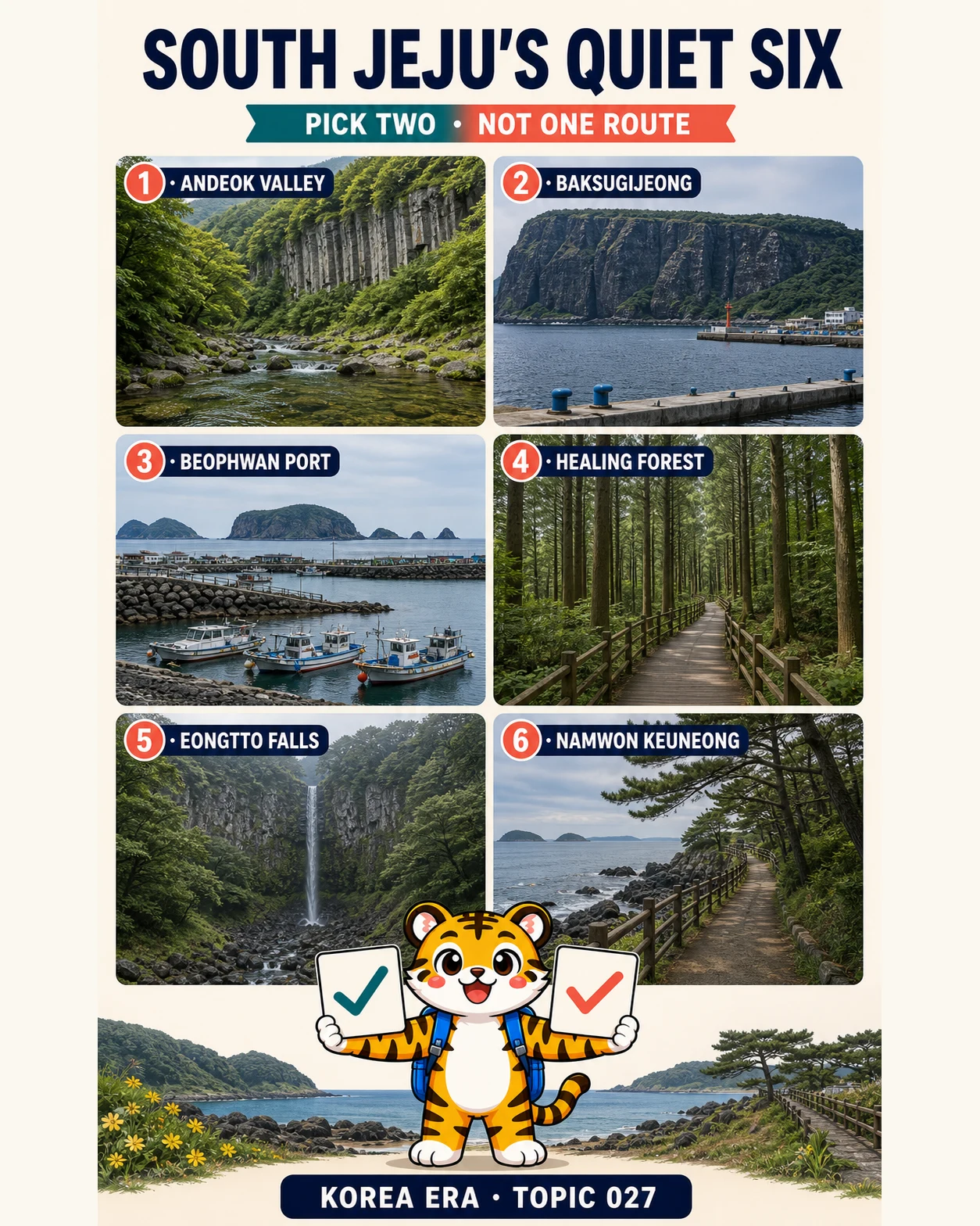
Korea Era tiger mascot holding two checked choice cards below six south-Jeju landscape panels
Illustrated overview · live details and sources are listed below.
TIME
Pick 2 · half day to full day
BUDGET
Mostly transport + optional admission
BEST FOR
Repeat Jeju visitors · slower days
MOVE
Choose one south-coast cluster

THE DESTINATION EDIT

6 destinations, each with a reason.

Choose one gateway for one day. The rail threshold is not permission to combine distant cities.
01

SOUTHWEST · CHOOSE 1–2

Protected valley or a port-side cliff view

These Andeok choices sit close enough to pair. Treat the valley as protected habitat and admire Baksugijeong from Daepyeong Port rather than seeking an exposed cliff-edge pose.
  1. 01

    Andeokgyegok Valley

    안덕계곡

    A clear stream crosses flat bedrock below folding-screen cliffs and a protected subtropical evergreen forest with more than 300 plant species.

    Public natural site; confirm live access conditionsNo swimming, cooking, plant collecting, wildlife capture or off-trail shortcut; follow current barriers and signs
  2. 02

    Baksugijeong from Daepyeong Port

    박수기정 · 대평포구

    The safest, most legible view places Daepyeong Port in the foreground and the roughly 100-metre cliff wall across the water.

    Public port viewpoint; parking and cafés varyDo not trespass for a cliff-top view, block working-port access or plan around a guaranteed sunset
02

SEOGWIPO EDGE · CHOOSE 1–2

Working coast or reservation-led forest

Beophwan is a living harbour and the Healing Forest is a managed visitor site. Choose the coast for an open walk or the forest only after checking the current booking and admission page.
  1. 01

    Beophwan Port

    법환포구

    A small working harbour on Jeju Olle Course 7 opens toward Beomseom, Seopseom, Munseom and Saeseom without requiring the full trail.

    Public harbour; nearby businesses varyGive boats and residents room, keep away from rough water and exposed rocks, and take only a short Olle section unless the 14.7 km route is your whole plan
  2. 02

    Seogwipo Forest of Healing

    서귀포 치유의숲

    Maintained cedar paths, wooden rest areas and a larger trail network make this the calmest managed-forest choice of the six.

    Check the official e-ticket site for current admission and programsReservation, entry rules and program availability can change; never assume walk-in access or a therapeutic outcome
03

RAIN SWITCH OR SOUTHEAST · CHOOSE 1

A conditional cascade or a fenced coastal promenade

Eongtto is a weather-dependent substitute after enough recent mountain rain, not a permanent waterfall. Namwon Keuneong is the dependable walking choice when the path and coast are safe.
  1. 01

    Eongtto Falls

    엉또폭포

    A narrow cascade can appear on a roughly 50-metre forested cliff after sufficient recent rain in Jeju’s mountain area.

    Public viewpoint; verify current path and weatherIt is usually dry. Never chase flow during severe rain, flood risk, high wind or a closed-path notice
  2. 02

    Namwon Keuneong Promenade

    남원 큰엉 해안경승지

    A roughly 1.5 km fenced promenade follows basalt cliffs and pine shade with an open view across Jeju’s southern sea.

    Public promenade; confirm path conditionsStay behind the fence and on the maintained path; do not enter wave-cut caves, climb rocks or copy exposed fishing positions

DESTINATION MAP

South Jeju’s quiet six — pick two, not one route

6 destination pins
Route map · ordered stops and live map links are ready below.
SOUTHWEST · CHOOSE 1–2
SEOGWIPO EDGE · CHOOSE 1–2
RAIN SWITCH OR SOUTHEAST · CHOOSE 1
No route line is drawn between cities. Pick one destination, then check live rail and local transport before leaving.

YOUR SHORTLIST

Build a personal Chungcheong shortlist.

Mark the destinations you would actually consider. Your shortlist stays on this device.
Korea Era tiger mascot celebrating a completed route
0of 6 destinations
0%

SOUTHWEST · CHOOSE 1–2

SEOGWIPO EDGE · CHOOSE 1–2

RAIN SWITCH OR SOUTHEAST · CHOOSE 1

No account needed. This shortlist is saved only in this browser.

EDITOR’S NOTES

The choices that make this edit work.

PICK RULE

Two nearby choices make the day

Pair Andeok Valley with Daepyeong, or Beophwan with the Healing Forest. Namwon works as a separate southeast finish; six saved pins are not one route.

Less driving, more place
RAIN SWITCH

A dry Eongtto is normal

Open the live weather and path check only after recent mountain rain. If flow is uncertain or conditions are unsafe, choose Keuneong or another maintained walk.

No waterfall guarantee
LOCAL RESPECT

Quiet is relative, not a promise

Ports, villages and forests still have residents, workers, booked visitors and busy periods. Keep voices down, park legally and leave access clear.

No ‘secret’ or crowd claim

BEFORE YOU GO

What can still change

  • These are six alternatives, not one route. Pick two in the same south-coast cluster; crossing from Andeok to Namwon just to collect every pin defeats the slower-day idea.
  • ‘Quiet’ is relative. None of these places is secret, empty or guaranteed uncrowded, and current weather, closures, village life and tour groups can change the experience.
  • Andeok Valley’s evergreen forest is protected as Natural Monument 377. Do not collect plants, capture wildlife, swim, cook, leave the permitted path or treat the stream as a water-play site.
  • Visit Jeju says Baksugijeong’s full cliff wall is better seen from near Daepyeong Port than from the cliff itself. Use public viewpoints, respect private land and working access, and do not make sunset a condition of the visit.
  • Beophwan is a working village harbour and part of Jeju Olle Course 7. A short waterside section can fit this guide; the full official course is 14.7 km, takes about 4–5 hours and is a separate commitment.
  • Seogwipo Forest of Healing has a managed trail network and programs that use advance reservations. Check the official e-ticket page for current admission, footwear, food, smoking, pet and program rules; this guide does not guarantee walk-in entry.
  • Eongtto Falls is usually dry and appears only after enough recent rain in Jeju’s mountain area. A campaign image cannot prove flow. Never approach during severe weather, flooding, high wind or a path closure.
  • Namwon Keuneong’s official coastal description includes a roughly 1.5 km safety-fenced promenade. Stay behind barriers and do not enter caves or climb onto wave-exposed basalt, even if older destination text or photographs show people there.
  • For public transport, choose one cluster and rebuild every transfer in the live Jeju Bus Information System. Rural gaps make six pins unsuitable for a fixed bus itinerary.
  • Keep a charged phone and share the selected pair. Call 112 for police, 119 for fire or medical emergency and 1330 for multilingual travel help.

USEFUL KOREAN

4 phrases for this edit

이 길로 가도 돼요?
May I use this path?
오늘 예약 없이 들어갈 수 있어요?
Can I enter without a reservation today?
오늘 엉또폭포에 물이 흘러요?
Is Eongtto Falls flowing today?
출입 금지 구역이 어디예요?
Which area is off-limits?

CHECKED SOURCES

The illustration is not the source.

Changing facts are linked to the public body or tourism operator responsible for them.
  1. Official Jeju Tourism GuidebookOfficial island map and south-Jeju planning context; live notices override printed details.Open official source ↗
  2. Visit Jeju · Andeokgyegok ValleyOfficial landscape, Natural Monument 377 and protected-nature rules.Open official source ↗
  3. Visit Jeju · BaksugijeongOfficial cliff, Daepyeong Port viewpoint and Olle context.Open official source ↗
  4. Visit Jeju · 2026 south-coast recommendationsCurrent local-life walking context around Daepyeong Port and Baksugijeong.Open official source ↗
  5. Visit Jeju · Beophwan PortOfficial working-harbour history, islet views and Olle Course 7 context.Open official source ↗
  6. Visit Jeju · Jeju Olle Course 7Official 14.7 km, 4–5 hour and medium-difficulty context for the full route.Open official source ↗
  7. Visit Jeju · Seogwipo Forest of HealingOfficial trail-network, maintained-path and advance-program-reservation context.Open official source ↗
  8. Seogwipo · Forest of Healing e-ticketPrimary current source for admission, reservations, programs and visitor rules.Open official source ↗
  9. Visit Jeju · forest wellness guideOfficial preparation and visitor-etiquette context; recheck all live limits.Open official source ↗
  10. Visit Jeju · Eongtto FallsOfficial height, access path and rain-dependent flow description.Open official source ↗
  11. Visit Jeju · waterfall field guideOfficial statement that Eongtto requires recent mountain rain; published guide advises reconfirmation.Open official source ↗
  12. Visit Jeju · Namwon Keuneong PromenadeOfficial destination coordinates and basalt-cliff context; current barriers control.Open official source ↗
  13. Visit Jeju · coastal promenade guideOfficial roughly 1.5 km fenced-walk description and pine-rest context.Open official source ↗
  14. Jeju Bus Information SystemOfficial live routes, stops, arrivals and service notices for a one-cluster transit version.Open official source ↗
  15. Korea Tourism Organization · 1330Official multilingual travel helpline and emergency-support context.Open official source ↗

NEXT EDIT

Choose another kind of day.

3 nights · 4 daysSeoul in 3 nights and 4 real days3 nights · 4 calendar daysCity dayOne first day in Seoul without crossing the city twice1 day · suggested 09:00–20:00Budget dayA full Seoul day for ₩50,0001 day · 08:30–20:30